
Fichier:Mars topography (MOLA dataset).png

Taille de cet aperçu : 800 × 361 pixels. Autres résolutions : 320 × 144 pixels | 640 × 289 pixels | 1 024 × 462 pixels | 1 280 × 578 pixels | 2 880 × 1 300 pixels.
Fichier d’origine (2 880 × 1 300 pixels, taille du fichier : 2,24 Mio, type MIME : image/png)
| Ce fichier et sa description proviennent de Wikimedia Commons. | Accéder au fichier sur Commons |
.png?uselang=fr)
Description
| Description |
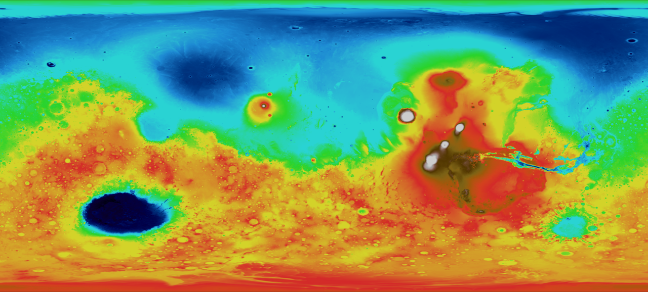
English: This map depicts topography, or surface features, of the planet Mars. In this image, white and red features are highest in relative elevation, while green and blue areas are lowest. This image was made possible by data from the Mars Orbiter Laser Altimeter (MOLA), which bounced a laser off the surface of the planet and calculated the distance traveled by the beam of light. |
| Date | Data collected in 2000 |
| Source | |
| Auteur |
NASA - Goddard Space Flight Center |
| Autres versions |
.png) .png) |
.jpg)
Conditions d’utilisation
| Ce fichier provient de la NASA. Sauf exception, les documents créés par la NASA ne sont pas soumis à copyright. Pour plus d'informations, voir la politique de copyright de la NASA. | ||
 |
Attention :
|
Historique du fichier
Cliquer sur une date et heure pour voir le fichier tel qu'il était à ce moment-là.
| Date et heure | Vignette | Dimensions | Utilisateur | Commentaire | |
|---|---|---|---|---|---|
| actuel | 4 mars 2009 à 22:49 | | 2 880 × 1 300 (2,24 Mio) | Tryphon | Gimp messed the colors up somehow, converting from TIFF to PNG; this one was converted using Imagemagick and seems fine. |
| 4 mars 2009 à 22:23 |  | 2 880 × 1 300 (2,13 Mio) | Tryphon | == Summary == {{Information |Description={{en|1=This map depicts topography, or surface features. In this image, white and red features are highest in relative elevation, while green and blue areas are lowest. This image was made possible by data from the |
Utilisation du fichier
Les 2 pages suivantes utilisent ce fichier :
Usage global du fichier
Les autres wikis suivants utilisent ce fichier :
- Utilisation sur fr.wikipedia.org
- Utilisation sur zh.wikipedia.org
.png)